Hunting Maps
The Victorian hunting maps show where hunting game and pest species is permitted on public land in Victoria.
Some areas open to hunting can be easily identified due to distinct and easily recognisable boundaries (e.g. roads) while others can be difficult to identify and are only defined by physical features or lines on a map.
There are two options you can choose from to check where hunting is permitted on public land in Victoria.
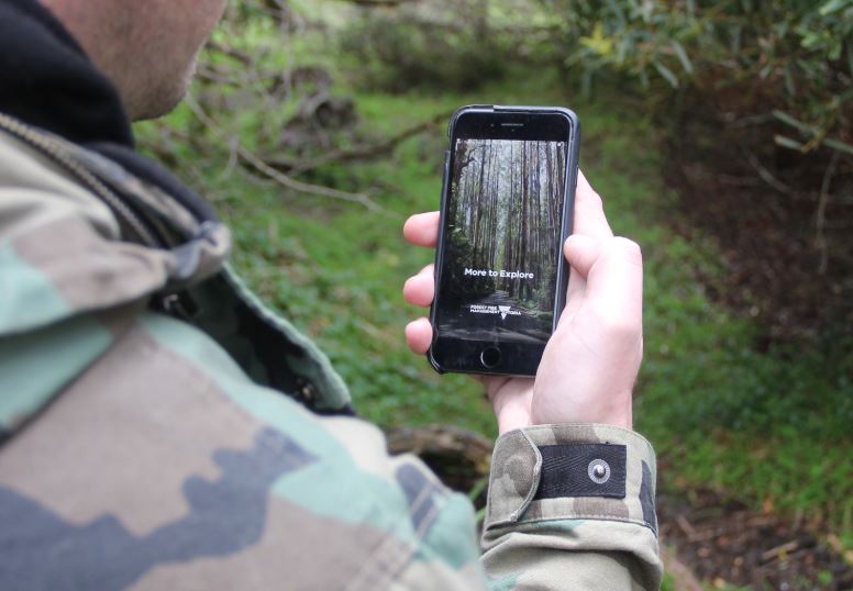
Digital hunting maps are available in the More To Explore mobile phone app.
The digital mapping system shows all public land available to hunting and the species that can be hunted in specific areas, including game species and pests.
The maps can also be downloaded for use offline, when out of mobile range.
The app also provides comprehensive information on State Forest camping sites and other activities, including bushwalking and mountain bike trails as well as 4WD tracks and seasonal road closures.
More To Explore is available for iPhones from the App Store and for Androids in the Google Play store.
Visit the Explore Outdoors website for more information on the More to Explore App.
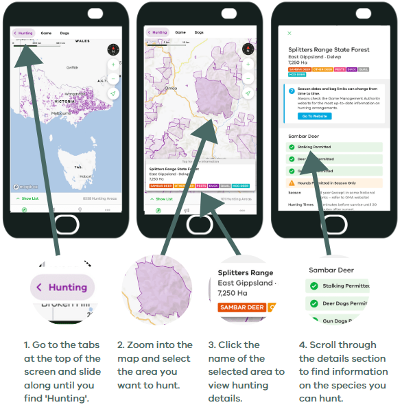
Find areas to hunt
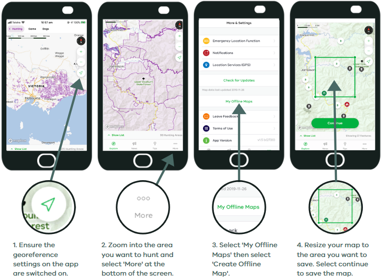
Using maps offline
Visit the Explore Outdoors website for more information on the More to Explore App.
MapShareVic - More to Explore is an online interactive mapping system, which hosts a number of different mapping layers for public land. It contains new game and pest animal hunting layers for public land in Victoria.
These extensive maps are recommended for those with a strong internet connection.
To use the maps, visit MapShareVic.
Download More to Explore
Download the free More to Explore from the App Store or Google Play store.
![]()
![]()
Disclaimer
The More to Explore app and web-based maps are developed and owned by the Department of Energy, Environment and Climate Action (DEECA).
The content of this website is provided for information purposes only. The State of Victoria through DEECA makes no warranty, either express or implied, concerning the suitability, reliability, availability, timeliness or accuracy of the content of this website for any purpose. Information is provided on the basis that all persons accessing the site are solely responsible for assessing the relevance and accuracy of its content. You must view this website in full screen format. No liability is accepted for any information or services which may appear in any other format.
DEECA accepts no responsibility or liability for the condition or content of any information or services which may appear on any linked websites. To provide feedback about the More to Explore app or the web-based and online maps, please contact DEECA.
Page last updated: 20 May 2026