Victoria’s second aerial duck survey set to take flight
15/10/2021
The GMA is conducting its annual helicopter survey across Victoria to monitor the abundance of game duck populations, to help improve our knowledge of waterfowl ecology.
The GMA is conducting its annual helicopter survey across Victoria to monitor the abundance of game duck populations, to help improve our knowledge of waterfowl ecology.
The aerial survey will be conducted by experienced wildlife biologists recording the presence, species and number of game ducks on waterbodies across Victoria.
Satellite imaging will then be used to determine how much water is in the landscape, which will inform an estimate of the total abundance of each game duck species in the state.
GMA Chief Executive Officer Graeme Ford said this is the largest and most comprehensive survey of game ducks undertaken in Victoria.
“The aerial survey was conducted for the first time in 2020, as part of a pilot to test the monitoring program design and evaluate its effectiveness to count duck numbers on Victorian water bodies.” Mr Ford said.
“An evaluation of the first survey has since found that the methodology for conducting the surveys was robust, and that the data collected is viable.”
“In addition to the 2020 monitoring programme which surveyed wetlands, sewerage ponds and farm dams we will now also be surveying irrigation channels, creeks and rivers.”
“Results from this research give us a better understanding of game duck populations and will be used in the future to help inform adaptive harvest management to set sustainable duck season arrangements.”
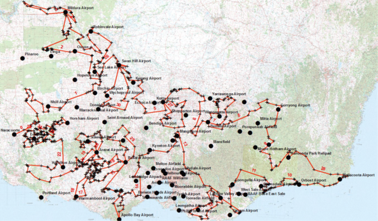
The 2021 survey will take place from approximately 19 October - 15 November, subject to weather conditions or other delays and will cover much of the state where ducks are found.
A map of the flight paths is available at https://bit.ly/2YV9tBg. The flight schedule may change from day to day, depending on weather conditions or other factors.
Residents in the areas where the surveys will take place may see a helicopter flying at low levels for a short time and for no longer than is necessary. The safety of people and livestock is a priority.
Results of the 2021 survey will be made available on the GMA website following conclusion of the program.
FAQ's
What is happening, why are there helicopters in my area?
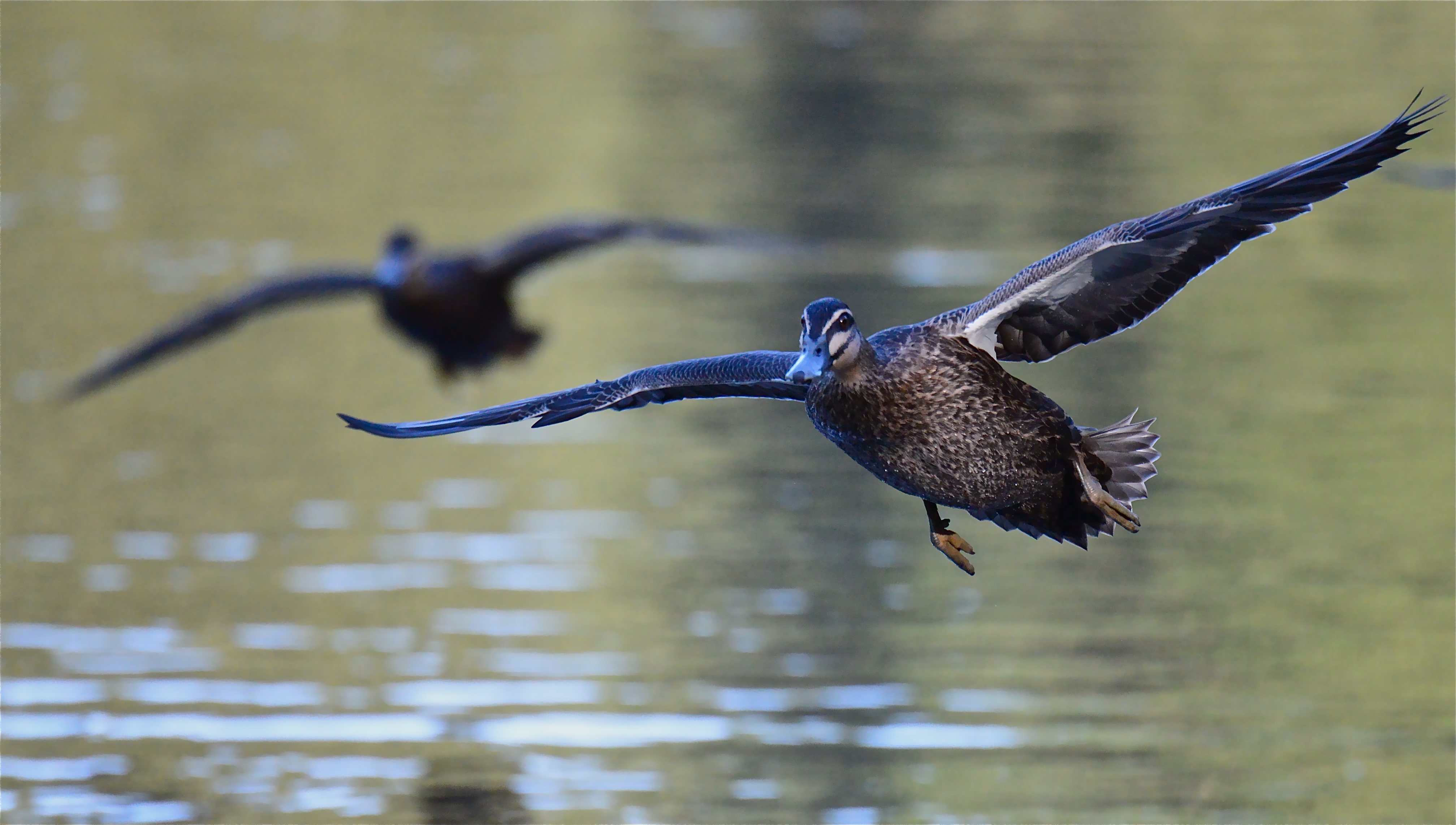
The GMA is conducting its annual helicopter survey across Victoria to monitor the abundance of game duck populations, to help improve our knowledge of waterfowl ecology. Helicopters will be used to count the species and number of ducks on farm dams, natural wetlands, rivers, irrigation channels and sewerage ponds across regional Victoria.
This study was designed by wildlife scientists from the Arthur Rylah Institute for the environment (ARI). Samples of waterbodies were drawn using a stratified random sampling design with the strata being the waterbody type as well as region (North, South, East West). This sampling design differs to that used previously for the pilot study, which used a multistage (clustered) sampling design based on 10 km hexagonal sampling units.
Satellite imaging will then be used to determine how much water is in the landscape, which will inform an estimate of the total abundance of each game duck species in the state.
The monitoring program will be used to support adaptive harvest management (AHM) for setting sustainable duck hunting arrangements each year.
When are the surveys taking place?
The surveys are taking place from 18 October 2021 to 4 November 2021 at selected waterbodies throughout regional Victoria. The flight schedule may change from day to day, depending on weather conditions or other factors.
Why is the GMA conducting game duck monitoring surveys / What are the benefits of this pilot project / the monitoring program?
The information and understanding gained by this monitoring program will benefit wildlife conservation by improving our understanding of what drives waterfowl populations and by providing information on the health of our waterfowl populations. It will ensure that duck hunting remains sustainable and will also provide important indicators about the health of our waterways and the broader environment. This study also runs in parallel with, and complements the Eastern Aerial Waterbird Survey conducted by Professor Richard Kingsford, now in its 39th consecutive year.
Why are farm dams included in the survey?
Farms dams provide important habitat for Wood Duck, which is an important game duck, that typically makes up about one-third of the total annual harvest. Other important game ducks, including Black Ducks and Grey Teal, also use farm dams.
Helicopters will allow these areas to be counted and improve our estimates of the total abundance of game ducks across the state. There are also many areas where helicopter access isn’t possible (sensitive livestock, powerlines and infrastructure). To allow counts of game ducks in these areas, ecologists have been contracted to conduct ground counts.
I am concerned about helicopters flying low over my property and potentially disturbing my livestock – what will be the impact / timeframe / height of helicopters flying over my property?
Farm dams on private land need to be surveyed to ensure an accurate estimate of game duck populations. This will involve helicopters flying at low levels, at approximately 30-50 metres, over the farm dam for a very short time and for no longer than is necessary.
For a typical sized farm dam, it will take no longer than a couple of minutes to survey. The survey team will only record data on the number of ducks and the species present and wetland characteristics, such as how full the dam is and whether any vegetation is present.
What will be done to protect stock on my property?
An experienced wildlife survey company and helicopter operator have been contracted to undertake the aerial survey. Minimising disturbance to stock, protecting assets and ensuring public safety are the highest priorities.
Each water body will be individually assessed via satellite imagery and the helicopter at high altitude before being surveyed at a lower altitude. Cattle will not be cornered in paddocks and any dams with horses, calves or lambs will not be surveyed to avoid stress or injury to stock.
Low-flying helicopters will not be flying within 300 metres of residences, as per the Civil Aviation Safety Authority (CASA) regulations.
GMA Game Duck Aerial Survey – Aircraft Operations Plan, 2021